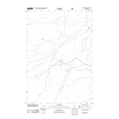
2011 Map of Rein Lake
USGS Topo · Published 2011About this map
The ranching landscape of central Montana is defined here by the intricate convergence of the American Fork and Sweet Grass Creek drainages. In this 2011 survey, the American Fork Ranch and Anchor Ranch stand as primary landmarks, illustrating the enduring agricultural patterns of Wheatland County. The local water management system is clearly mapped, including the Ryan-Tronrud Dam at Rein Lake and the extensive American Fork Ranch Ditch, which redirects water across the valley. For those tracing local family history, the Hopkins Cemetery is a significant genealogical site, situated near the headwaters of O'Hearn Creek. The topography is shaped by numerous seasonal and perennial flows such as Big Elk Creek and Lebo Creek, which drain the open country between established access points like Rein Rd.
Find a feature on this map
22 named features on this map. Tap any name to fly to it.
Don’t see what you’re looking for? This feature index may not catch every label — zoom into the map to look around manually.
Map Details
Editions of this 2011 Rein Lake Map
This is the sole edition of this map. No revisions or reprints were ever made.
Other maps of this area

1886 · Little Belt Mts.
USGS Topo · 1:250,000

1894 · Little Belt Mts.
USGS Topo · 1:250,000

1897 · Little Belt Mts.
USGS Topo · 1:250,000

1898 · Little Belt Mts.
USGS Topo · 1:250,000

1902 · Little Belt Mts.
USGS Topo · 1:250,000

1948 · White Sulphur Springs
USGS Topo · 1:250,000

1958 · White Sulphur Springs
USGS Topo · 1:250,000

1961 · White Sulphur Springs
USGS Topo · 1:250,000

1965 · White Sulphur Springs
USGS Topo · 1:250,000
1972 · Lebo Lake
USGS Topo · 1:24,000