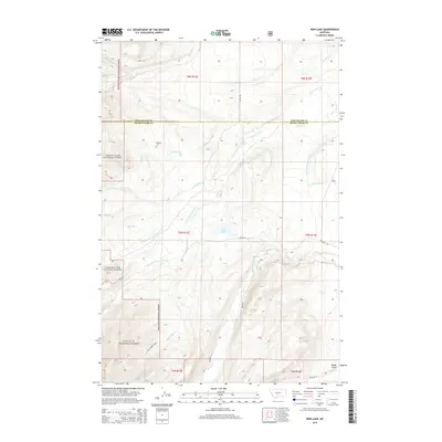
2014 Map of Rein Lake
USGS Topo · Published 2014About this map
Hopkins Cem sits on the western edge of this landscape where the Lewis & Clark National Forest meets the open range of Wheatland and Sweet Grass counties. The topography is defined by a dense network of watercourses, including the American Fork and its various branches, which carve through the high plains. Human modification of the landscape is evident through irrigation infrastructure like the American Fork Ranch Ditch and Tronrud Ditch, reflecting the region's agricultural reliance on redirected mountain runoff. To the south, the terrain rises into the Gallatin National Forest, where steep drainages like Blackberry Creek and Rough Gulch descend toward the namesake Rein Lake. This 2014 survey documents a rugged interface between protected federal timberlands and private ranching interests, marked by long-established gravel routes such as Rein Rd.
Find a feature on this map
33 named features on this map. Tap any name to fly to it.
Don’t see what you’re looking for? This feature index may not catch every label — zoom into the map to look around manually.
Map Details
Editions of this 2014 Rein Lake Map
This is the sole edition of this map. No revisions or reprints were ever made.
Other maps of this area

1886 · Little Belt Mts.
USGS Topo · 1:250,000

1894 · Little Belt Mts.
USGS Topo · 1:250,000

1897 · Little Belt Mts.
USGS Topo · 1:250,000

1898 · Little Belt Mts.
USGS Topo · 1:250,000

1902 · Little Belt Mts.
USGS Topo · 1:250,000

1948 · White Sulphur Springs
USGS Topo · 1:250,000

1958 · White Sulphur Springs
USGS Topo · 1:250,000

1961 · White Sulphur Springs
USGS Topo · 1:250,000

1965 · White Sulphur Springs
USGS Topo · 1:250,000
1972 · Lebo Lake
USGS Topo · 1:24,000