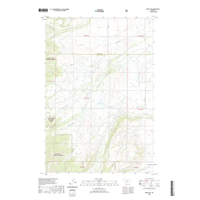
2020 Map of Rein Lake
USGS Topo · Published 2020About this map
Hopkins Cem serves as a small but vital genealogical landmark in this section of the Montana high country, situated near where the Wheatland and Sweet Grass county line divides the landscape. This area is characterized by a complex network of mountain drainages, most notably the American Fork and its various branches, alongside Sweet Grass Creek. The transition between protected public lands is clear, as the Lewis & Clark National Forest and Gallatin National Forest cover the western portion of the sheet.
Find a feature on this map
37 named features on this map. Tap any name to fly to it.
Don’t see what you’re looking for? This feature index may not catch every label — zoom into the map to look around manually.
Map Details
Editions of this 2020 Rein Lake Map
This is the sole edition of this map. No revisions or reprints were ever made.
Other maps of this area

1886 · Little Belt Mts.
USGS Topo · 1:250,000

1894 · Little Belt Mts.
USGS Topo · 1:250,000

1897 · Little Belt Mts.
USGS Topo · 1:250,000

1898 · Little Belt Mts.
USGS Topo · 1:250,000

1902 · Little Belt Mts.
USGS Topo · 1:250,000

1948 · White Sulphur Springs
USGS Topo · 1:250,000

1958 · White Sulphur Springs
USGS Topo · 1:250,000

1961 · White Sulphur Springs
USGS Topo · 1:250,000

1965 · White Sulphur Springs
USGS Topo · 1:250,000
1972 · Lebo Lake
USGS Topo · 1:24,000