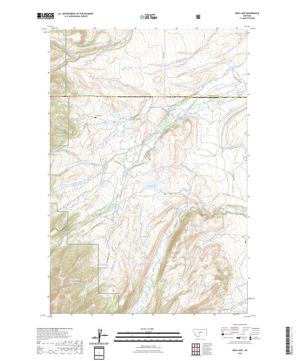
2024 Map of Rein Lake
USGS Topo · Published 2024About this map
The Crazy Mountains dominate the southwestern portion of this map, marking a transition from high peaks into the rolling watershed of the Sweet Grass Creek and American Fork river systems. This modern survey illustrates the remote high-country landscape along the boundary of Wheatland Co and Sweet Grass Co, where the Lewis & Clark National Forest and Gallatin National Forest converge. Settlement is sparse, defined by large ranching tracts and water management features like the Tronrud Ditch. Evidence of local history is found at Hopkins Cem, located near O'Hearn Creek and Agnes Creek. The land is primarily accessed by a network of rural routes such as Big Elk Rd and State Hwy 371, which service the scattered holdings surrounding Rein Lake.
Find a feature on this map
34 named features on this map. Tap any name to fly to it.
Don’t see what you’re looking for? This feature index may not catch every label — zoom into the map to look around manually.
Map Details
Editions of this 2024 Rein Lake Map
This is the sole edition of this map. No revisions or reprints were ever made.
Other maps of this area

1886 · Little Belt Mts.
USGS Topo · 1:250,000

1894 · Little Belt Mts.
USGS Topo · 1:250,000

1897 · Little Belt Mts.
USGS Topo · 1:250,000

1898 · Little Belt Mts.
USGS Topo · 1:250,000

1902 · Little Belt Mts.
USGS Topo · 1:250,000

1948 · White Sulphur Springs
USGS Topo · 1:250,000

1958 · White Sulphur Springs
USGS Topo · 1:250,000

1961 · White Sulphur Springs
USGS Topo · 1:250,000

1965 · White Sulphur Springs
USGS Topo · 1:250,000
1972 · Lebo Lake
USGS Topo · 1:24,000