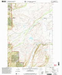
2000 Map of Rein Lake
USGS Topo · Published 2005About this map
Sweet Grass Creek flows through a landscape defined by the intersection of mountain ranges and ranching history at the turn of the 21st century. The map captures a high-elevation region where the Lewis and Clark National Forest and Gallatin National Forest converge, anchored by the prominent Loco Mountain. While much of the terrain is dominated by the complex drainage systems of the North Fork Elk Creek and American Fork, the human footprint is centered on established grazing operations and rural landmarks. Local history is preserved at the Hopkins Cem and through historic properties such as the American Fork Ranch and Anchor Ranch. The presence of Rein Lake and various named forks, including Agnes Creek and Hearn Creek, illustrates the essential relationship between water sources and high-plains agriculture in this part of Montana.
Find a feature on this map
25 named features on this map. Tap any name to fly to it.
Don’t see what you’re looking for? This feature index may not catch every label — zoom into the map to look around manually.
Map Details
Editions of this 2000 Rein Lake Map
This is the sole edition of this map. No revisions or reprints were ever made.
Other maps of this area

1886 · Little Belt Mts.
USGS Topo · 1:250,000

1894 · Little Belt Mts.
USGS Topo · 1:250,000

1897 · Little Belt Mts.
USGS Topo · 1:250,000

1898 · Little Belt Mts.
USGS Topo · 1:250,000

1902 · Little Belt Mts.
USGS Topo · 1:250,000

1948 · White Sulphur Springs
USGS Topo · 1:250,000

1958 · White Sulphur Springs
USGS Topo · 1:250,000

1961 · White Sulphur Springs
USGS Topo · 1:250,000

1965 · White Sulphur Springs
USGS Topo · 1:250,000
1972 · Lebo Lake
USGS Topo · 1:24,000