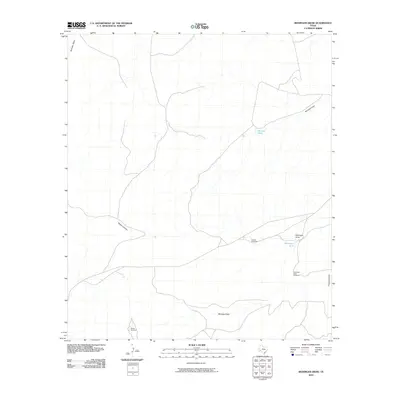
2010 Map of Reininger Draw
USGS Topo · Published 2010About this map
Reininger Draw defines the drainage patterns of this arid Pecos County landscape, where water management is the primary marker of human activity. The map reveals a network of ephemeral watercourses and vital ranching infrastructure, including Morales Tank and Reininger Tank. These features, combined with family-named landmarks like Nevins Windmills and Roark Windmill, illustrate the logistical requirements of cattle ranching in West Texas during the early 21st century. The isolated F C Ranch serves as the lone named settlement node, situated among topographic landmarks such as Nevins Canyon and Fortyone Draw. The distribution of these windmills and draws provides a clear record of land use and resource navigation in a region where seasonal water flow dictates the geography of the range.
Find a feature on this map
11 named features on this map. Tap any name to fly to it.
Don’t see what you’re looking for? This feature index may not catch every label — zoom into the map to look around manually.
Map Details
Editions of this 2010 Reininger Draw Map
This is the sole edition of this map. No revisions or reprints were ever made.
Other maps of this area

1920 · Longfellow
USGS Topo · 1:125,000

1923 · Sierra Madera
USGS Topo · 1:62,500

1928 · Comanche Spring
USGS Topo · 1:125,000

1954 · Fort Stockton
USGS Topo · 1:250,000

1958 · Fort Stockton
USGS Topo · 1:250,000

1968 · Cap Rock Butte
USGS Topo · 1:24,000

1968 · F C Ranch
USGS Topo · 1:24,000

1968 · Marathon Gap
USGS Topo · 1:24,000

1968 · Ebers Camp
USGS Topo · 1:24,000

1968 · Dimple Hills
USGS Topo · 1:24,000