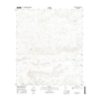
2016 Map of Reininger Draw
USGS Topo · Published 2016About this map
Morales Draw and Reininger Draw carve paths through this section of Pecos County, defining the drainage patterns of an arid landscape in the mid-2010s. The region is characterized by its vital water management features, including several cattle tanks and reservoirs that serve the ranching economy. Significant landmarks such as Watermelon Water Tank and Roack Water Tank stand as specific points of interest for land management and local navigation. The terrain is further etched by secondary channels like Nevins Draw and Fortyone Draw, illustrating the complex network of ephemeral watercourses that dominate this part of West Texas. This topographical study offers a clear look at how water resources are identified and labeled in a sparsely populated ranching territory.
Find a feature on this map
8 named features on this map. Tap any name to fly to it.
Don’t see what you’re looking for? This feature index may not catch every label — zoom into the map to look around manually.
Map Details
Editions of this 2016 Reininger Draw Map
This is the sole edition of this map. No revisions or reprints were ever made.
Other maps of this area

1920 · Longfellow
USGS Topo · 1:125,000

1923 · Sierra Madera
USGS Topo · 1:62,500

1928 · Comanche Spring
USGS Topo · 1:125,000

1954 · Fort Stockton
USGS Topo · 1:250,000

1958 · Fort Stockton
USGS Topo · 1:250,000

1968 · Cap Rock Butte
USGS Topo · 1:24,000

1968 · F C Ranch
USGS Topo · 1:24,000

1968 · Marathon Gap
USGS Topo · 1:24,000

1968 · Ebers Camp
USGS Topo · 1:24,000

1968 · Dimple Hills
USGS Topo · 1:24,000