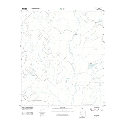
2010 Map of Reliance
USGS Topo · Published 2010About this map
Reliance anchors the northwest corner of this landscape, situated at the junction of FM 1179 and Riley Rd. The terrain is defined by the winding course of the Navasota River, which flows south through the center of the region, creating a complex network of wetlands and tributaries like Big Slough and Flat Pond. The influence of local ranching and water management is evident in the numerous private water bodies such as Carr Lake, K-Ranch Lake, and Brooke Lake, each marked by its own respective dam.
Find a feature on this map
46 named features on this map. Tap any name to fly to it.
Don’t see what you’re looking for? This feature index may not catch every label — zoom into the map to look around manually.
Map Details
Editions of this 2010 Reliance Map
This is the sole edition of this map. No revisions or reprints were ever made.
Other maps of this area

1931 · Iola
USGS Topo · 1:62,500

1954 · Austin
USGS Topo · 1:250,000

1956 · Bryan
USGS Topo · 1:62,500

1956 · Carlos
USGS Topo · 1:62,500

1959 · Clear Lake
USGS Topo · 1:24,000

1959 · Reliance
USGS Topo · 1:24,000

1959 · Ferguson Crossing
USGS Topo · 1:24,000

1960 · Carlos
USGS Topo · 1:24,000

1961 · Wellborn
USGS Topo · 1:24,000

1962 · Keith
USGS Topo · 1:24,000