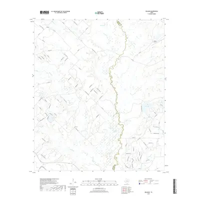
2019 Map of Reliance
USGS Topo · Published 2019About this map
The Navasota River forms a winding, marshy boundary between Brazos and Grimes counties, anchoring a landscape of bottomlands and oxbow lakes. In the northwest corner, the small community of Reliance is situated near Wickson Lake, while the local topography is defined by the braided networks of Bowman Cr and Wickson Cr. This 2019 survey documents a mix of rural ranchland and emerging residential subdivisions, particularly evident in the winding roads south of Brooke Lake. Genealogy researchers will find the Stick Cem located along Wickson Cr, a notable point of local historical continuity. The area's aviation and recreation interests are represented by the K Ranch Airport and several substantial water bodies including Stewart Lake and Carr Lake. The presence of features like Goon Fishhole Slough and Big Slough highlights the complex drainage system typical of this Texas river valley.
Find a feature on this map
92 named features on this map. Tap any name to fly to it.
Don’t see what you’re looking for? This feature index may not catch every label — zoom into the map to look around manually.
Map Details
Editions of this 2019 Reliance Map
This is the sole edition of this map. No revisions or reprints were ever made.
Other maps of this area

1931 · Iola
USGS Topo · 1:62,500

1954 · Austin
USGS Topo · 1:250,000

1956 · Bryan
USGS Topo · 1:62,500

1956 · Carlos
USGS Topo · 1:62,500

1959 · Clear Lake
USGS Topo · 1:24,000

1959 · Reliance
USGS Topo · 1:24,000

1959 · Ferguson Crossing
USGS Topo · 1:24,000

1960 · Carlos
USGS Topo · 1:24,000

1961 · Wellborn
USGS Topo · 1:24,000

1962 · Keith
USGS Topo · 1:24,000