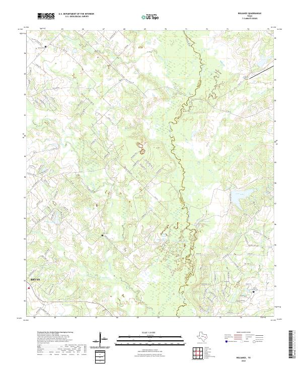
2022 Map of Reliance
USGS Topo · Published 2022About this map
The Navasota River meanders along the eastern edge of this Brazos County landscape, forming a complex boundary with numerous wetland features like Big Slough, Flat Pond, and Goon Fishhole Slough. The area north of Bryan shows a transition from suburban expansion to rural reaches defined by family-named roads and historical sites. Genealogy researchers will find several well-marked burial grounds including Reliance Cem and the Stick Cem along Weedon Loop, as well as the Martins Prairie Cem near the southeast corner.
Find a feature on this map
101 named features on this map. Tap any name to fly to it.
Don’t see what you’re looking for? This feature index may not catch every label — zoom into the map to look around manually.
Map Details
Editions of this 2022 Reliance Map
This is the sole edition of this map. No revisions or reprints were ever made.
Other maps of this area

1931 · Iola
USGS Topo · 1:62,500

1954 · Austin
USGS Topo · 1:250,000

1956 · Bryan
USGS Topo · 1:62,500

1956 · Carlos
USGS Topo · 1:62,500

1959 · Clear Lake
USGS Topo · 1:24,000

1959 · Reliance
USGS Topo · 1:24,000

1959 · Ferguson Crossing
USGS Topo · 1:24,000

1960 · Carlos
USGS Topo · 1:24,000

1961 · Wellborn
USGS Topo · 1:24,000

1962 · Keith
USGS Topo · 1:24,000