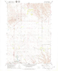
1978 Map of Reliance
USGS Topo · Published 1979About this map
Reliance sits at a geographic crossroads in central South Dakota, where the plains of Lafayette and Fairland townships meet. The landscape is defined by the winding course of American Crow Creek and the proximity of the Lower Brule Indian Reservation Boundary to the north and east. This era shows the community's critical transport infrastructure, with Interstate 90 bisecting the region alongside the traditional route of the Chicago Milwaukee St Paul and Pacific railroad.
Find a feature on this map
14 named features on this map. Tap any name to fly to it.
Don’t see what you’re looking for? This feature index may not catch every label — zoom into the map to look around manually.
Map Details
Editions of this 1978 Reliance Map
This is the sole edition of this map. No revisions or reprints were ever made.
Other maps of this area

1935 · Chamberlain
USGS Topo · 1:62,500

1939 · Chamberlain
USGS Topo · 1:62,500

1952 · Reliance SW
USGS Topo · 1:24,000

1952 · Reliance SE
USGS Topo · 1:24,000

1952 · Oacoma
USGS Topo · 1:24,000

1953 · Huron
USGS Topo · 1:250,000

1954 · Huron
USGS Topo · 1:250,000

1955 · Mitchell
USGS Topo · 1:250,000

1959 · Mitchell
USGS Topo · 1:250,000

1966 · Big Bend Dam
USGS Topo · 1:24,000