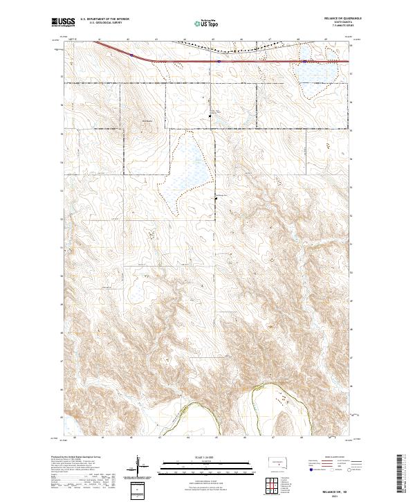
2021 Map of Reliance SW
USGS Topo · Published 2021About this map
The White River carves through the southern edge of this landscape, marking the boundary between Lyman and Tripp counties. This portion of the northern plains is defined by a series of intermittent drainages and modest landforms, such as Red Butte and the winding course of Bad Cr. The arrangement of section lines and gravel roads, including Schelske Rd and Brule Rd, reflects the enduring grid of the Public Land Survey System that dictates the placement of rural homesteads and agricultural operations.
Find a feature on this map
27 named features on this map. Tap any name to fly to it.
Don’t see what you’re looking for? This feature index may not catch every label — zoom into the map to look around manually.
Map Details
Editions of this 2021 Reliance SW Map
This is the sole edition of this map. No revisions or reprints were ever made.
Other maps of this area

1951 · Ideal NE
USGS Topo · 1:24,000

1952 · Reliance SW
USGS Topo · 1:24,000

1952 · Reliance SE
USGS Topo · 1:24,000

1952 · Hamill NW
USGS Topo · 1:24,000

1952 · Hamill NE
USGS Topo · 1:24,000

1955 · Mitchell
USGS Topo · 1:250,000

1959 · Mitchell
USGS Topo · 1:250,000
1978 · Lyman
USGS Topo · 1:24,000
1978 · Kennebec SE
USGS Topo · 1:24,000
1978 · Reliance
USGS Topo · 1:24,000