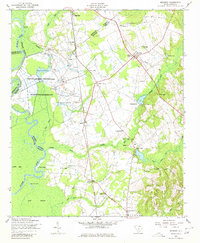
1953 Map of Rembert
USGS Topo · Published 1980About this map
The South Carolina Penitentiary and State Farm Number One dominate the fertile bottomlands near the Wateree River in this 1953 survey. The landscape is a complex network of agricultural and industrial operations, evidenced by conveyors and silos situated along the Southern railroad line. Inland from the river, the terrain rises into the Sandhills, where settlements like Rembert and Hagood serve as local hubs for a rural population centered around numerous country churches such as Saint Stephens Church and McLeod Chapel.
Find a feature on this map
46 named features on this map. Tap any name to fly to it.
Don’t see what you’re looking for? This feature index may not catch every label — zoom into the map to look around manually.
Map Details
Editions of this 1953 Rembert Map
2 editions found
Other maps of this area

1938 · Hagood
USGS Topo · 1:62,500

1941 · Spartanburg
USGS Topo · 1:250,000

1942 · Camden
USGS Topo · 1:125,000

1943 · Eastover
USGS Topo · 1:62,500

1946 · Sumter
USGS Topo · 1:62,500

1953 · Camden South
USGS Topo · 1:24,000

1953 · Eastover
USGS Topo · 1:24,000

1953 · Lugoff
USGS Topo · 1:24,000

1953 · Wedgefield
USGS Topo · 1:24,000

1953 · Rembert
USGS Topo · 1:24,000