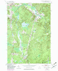
1951 Map of Remington Corners
USGS Topo · Published 1983About this map
Jadwin Memorial State Forest and the northern reaches of the Adirondack Park define this landscape in Lewis County, where the topography is shaped by the complex drainage of the Oswegatchie River. The area is characterized by numerous small settlements at road intersections, including Remington Corners, Tylers Corners, and Tinney Corners. These junctions suggest a historically dispersed rural population reliant on the timber and water power of the region, evidenced by sites like Kimball Mill and Bishas Mill.
Find a feature on this map
43 named features on this map. Tap any name to fly to it.
Don’t see what you’re looking for? This feature index may not catch every label — zoom into the map to look around manually.
Map Details
Editions of this 1951 Remington Corners Map
4 editions found
Other maps of this area

1911 · Lowville
USGS Topo · 1:62,500

1912 · Number Four
USGS Topo · 1:62,500

1913 · Lowville
USGS Topo · 1:62,500

1913 · Lake Bonaparte
USGS Topo · 1:62,500

1915 · Number Four
USGS Topo · 1:62,500

1916 · Lake Bonaparte
USGS Topo · 1:62,500

1916 · Oswegatchie
USGS Topo · 1:62,500

1918 · Oswegatchie
USGS Topo · 1:62,500

1948 · Ogdensburg
USGS Topo · 1:250,000

1950 · Utica
USGS Topo · 1:250,000