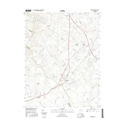
2016 Map of Remington
USGS Topo · Published 2016About this map
Remington sits at the confluence of the Rappahannock River and several major tributaries, anchoring a landscape that straddles the Fauquier and Culpeper county line. The terrain, located within the Culpeper Basin, is defined by a dense network of runs and branches, including Tinpot Run, Marsh Run, and Hubbard Run, which carve through the farmland. Local history is etched into the map through numerous burial grounds like Hollywood Cem and the Saint James Baptist Church Cem, alongside established crossroads such as Bealeton, Elkwood, and Opal. The region's transport infrastructure is prominently displayed, featuring the Culpeper Regional Airport and various secondary routes like Kellys Ford Rd. The map illustrates a developed rural corridor where aviation facilities and local settlements follow the natural drainage patterns of the Hazel River and Beales Br.
Find a feature on this map
115 named features on this map. Tap any name to fly to it.
Don’t see what you’re looking for? This feature index may not catch every label — zoom into the map to look around manually.
Map Details
Editions of this 2016 Remington Map
This is the sole edition of this map. No revisions or reprints were ever made.
Other maps of this area

1887 · Spottsylvania
USGS Topo · 1:125,000

1892 · Spottsylvania
USGS Topo · 1:125,000

1894 · Warrenton
USGS Topo · 1:125,000

1894 · Warrenton
USGS Topo · 1:62,500

1927 · Remington
USGS Topo · 1:48,000

1930 · Warrenton
USGS Topo · 1:62,500

1943 · Catlett
USGS Topo · 1:62,500

1943 · Germanna Bridge
USGS Topo · 1:24,000

1943 · Culpeper
USGS Topo · 1:24,000

1943 · Midland
USGS Topo · 1:24,000