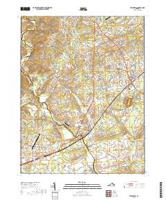
2019 Map of Remington
USGS Topo · Published 2019About this map
The Rappahannock River and Hazel River converge in this Piedmont landscape, forming a natural boundary between Fauquier and Culpeper counties. The town of Remington serves as a central hub, flanked by the residential and agricultural communities of Bealeton and Elkwood. This area is characterized by its aviation history and infrastructure, featuring the Culpeper Regional Airport, Aviacres Airport, and Rular Airport scattered across the basin. For genealogists and local historians, several landmark burial sites are preserved, including Saint James Baptist Church Cem and Cedar Grove Cem. The map detail traces the intricate drainage patterns of Tinpot Run, Marsh Run, and Craig Run as they flow through the Culpeper Basin, illustrating how the waterway network dictated the placement of early settlements and road crossings like Elkwood Xing.
Find a feature on this map
117 named features on this map. Tap any name to fly to it.
Don’t see what you’re looking for? This feature index may not catch every label — zoom into the map to look around manually.
Map Details
Editions of this 2019 Remington Map
This is the sole edition of this map. No revisions or reprints were ever made.
Other maps of this area

1887 · Spottsylvania
USGS Topo · 1:125,000

1892 · Spottsylvania
USGS Topo · 1:125,000

1894 · Warrenton
USGS Topo · 1:125,000

1894 · Warrenton
USGS Topo · 1:62,500

1927 · Remington
USGS Topo · 1:48,000

1930 · Warrenton
USGS Topo · 1:62,500

1943 · Catlett
USGS Topo · 1:62,500

1943 · Germanna Bridge
USGS Topo · 1:24,000

1943 · Culpeper
USGS Topo · 1:24,000

1943 · Midland
USGS Topo · 1:24,000