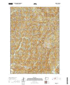
2020 Map of Remote
USGS Topo · Published 2020About this map
The Middle Fork Coquille River defines the southern reach of this landscape in Coos County, where the settlement of Remote sits near the Remote Bridge. This area is characterized by a dense network of watercourses, including Myrtle Creek, Sandy Cr, and Elk Cr, which flow through heavily dissected terrain. For local historians and genealogists, the map identifies specific burial sites such as the Enchanted Prairie Cem and Fetter Cem. These landmarks, along with established routes like Elk Mtn Loop Rd and Jenkins Prairie Rd, illustrate the long-standing community footprint in this part of the Oregon Coast Range. The survey provides a clear view of the complex timber and creek-based geography that has shaped the local economy and land use patterns.
Find a feature on this map
36 named features on this map. Tap any name to fly to it.
Don’t see what you’re looking for? This feature index may not catch every label — zoom into the map to look around manually.
Map Details
Editions of this 2020 Remote Map
This is the sole edition of this map. No revisions or reprints were ever made.
Other maps of this area

1896 · Coos Bay
USGS Topo · 1:125,000

1898 · Coos Bay
USGS Topo · 1:125,000

1899 · Port Orford
USGS Topo · 1:125,000

1900 · Coos Bay
USGS Topo · 1:125,000

1903 · Port Orford
USGS Topo · 1:125,000

1928 · Sitkum
USGS Topo · 1:125,000

1942 · Coquille
USGS Topo · 1:62,500

1945 · Coquille
USGS Topo · 1:62,500

1954 · Coos Bay
USGS Topo · 1:250,000

1954 · Bone Mountain
USGS Topo · 1:62,500