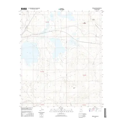
2017 Map of Remuda Basin
USGS Topo · Published 2017About this map
Remuda Basin defines the central topography of this modern high-desert survey in Eddy County. The landscape is characterized by its dramatic escarpments and interior drainage basins, most notably at Livingston Ridge and the nearby Forty-Niner Ridge. The western portion of the quadrangle is dominated by the alkaline waters of Salt Lake and the marshy expanses of Tamarisk Flat. Human activity in this arid region is largely defined by industrial and ranching infrastructure. The presence of Potash Mines Rd highlights the area's geological importance to the potash industry, while a network of rural routes including Mobley Ranch Rd and Rawhide Rd provides access to remote livestock operations and the seasonally varying waters of Lindsey Lake.
Find a feature on this map
18 named features on this map. Tap any name to fly to it.
Don’t see what you’re looking for? This feature index may not catch every label — zoom into the map to look around manually.
Map Details
Editions of this 2017 Remuda Basin Map
This is the sole edition of this map. No revisions or reprints were ever made.
Other maps of this area

1939 · Carlsbad
USGS Topo · 1:62,500

1939 · Nash Draw
USGS Topo · 1:62,500

1943 · Carlsbad
USGS Topo · 1:62,500

1943 · Nash Draw
USGS Topo · 1:62,500

1945 · Malaga
USGS Topo · 1:62,500

1946 · Malaga
USGS Topo · 1:62,500

1954 · Carlsbad
USGS Topo · 1:250,000

1954 · Hobbs
USGS Topo · 1:250,000

1958 · Carlsbad
USGS Topo · 1:250,000

1958 · Hobbs
USGS Topo · 1:250,000