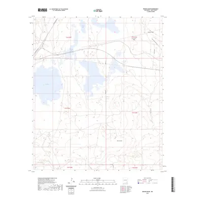
2023 Map of Remuda Basin
USGS Topo · Published 2023About this map
Remuda Basin defines the central topography of this corner of Eddy County, characterized by a series of alkaline depressions and prominent ridges. To the west, Salt Lake and Lindsey Lake mark low points in the terrain, while Livingston Ridge and Forty-Niner Ridge provide significant elevation to the north and east. The landscape's industrial character is indicated by the presence of Potash Mines Rd, a primary arterial route supporting the region's mineral extraction. Other local routes, such as Rawhide Rd and Mobley Ranch Rd, weave through the basin, connecting isolated ranching and mining interests. The transition from the high ridges down to Tamarisk Flat illustrates the complex drainage and sediment patterns typical of this arid New Mexico environment.
Find a feature on this map
17 named features on this map. Tap any name to fly to it.
Don’t see what you’re looking for? This feature index may not catch every label — zoom into the map to look around manually.
Map Details
Editions of this 2023 Remuda Basin Map
This is the sole edition of this map. No revisions or reprints were ever made.
Other maps of this area

1939 · Carlsbad
USGS Topo · 1:62,500

1939 · Nash Draw
USGS Topo · 1:62,500

1943 · Carlsbad
USGS Topo · 1:62,500

1943 · Nash Draw
USGS Topo · 1:62,500

1945 · Malaga
USGS Topo · 1:62,500

1946 · Malaga
USGS Topo · 1:62,500

1954 · Carlsbad
USGS Topo · 1:250,000

1954 · Hobbs
USGS Topo · 1:250,000

1958 · Carlsbad
USGS Topo · 1:250,000

1958 · Hobbs
USGS Topo · 1:250,000