
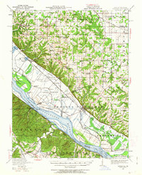
1940 Map of Renault
USGS Topo · Published 1955About this map
The Mississippi River dominates this landscape, its western banks lined with dramatic Bluffs while the river itself is divided by large masses such as Fort Chartres Island, Beagles Island, and Turkey Island. These islands and the adjacent bottomlands defined the agrarian economy of the region before 1940, where small settlements like Prairie du Rocher and Boxtown thrived near the river's edge. The complex waterway is further complicated by natural features like Ames Towhead and Lee Island, which influenced navigation and local land ownership.
Find a feature on this map
93 named features on this map. Tap any name to fly to it.
Don’t see what you’re looking for? This feature index may not catch every label — zoom into the map to look around manually.
Map Details
Editions of this 1940 Renault Map
2 editions found
Other maps of this area

1904 · Farmington
USGS Topo · 1:62,500

1906 · Farmington
USGS Topo · 1:62,500

1907 · Weingarten
USGS Topo · 1:62,500

1909 · Weingarten
USGS Topo · 1:62,500

1910 · Waterloo
USGS Topo · 1:62,500

1912 · New Athens
USGS Topo · 1:62,500

1912 · Kimmswick
USGS Topo · 1:62,500

1912 · Baldwin
USGS Topo · 1:62,500

1913 · Waterloo
USGS Topo · 1:62,500

1914 · Baldwin
USGS Topo · 1:62,500