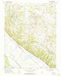
1970 Map of Renault
USGS Topo · Published 1972About this map
Maeystown, Fults, and Renault anchor this landscape along the bluff line overlooking the Mississippi River floodplain in Monroe County. The settlement pattern follows the distinct transition from the high, dissected terrain of Morrison Hollow to the flat alluvial bottomlands protected by a modern Levee. This contrast is sharply defined by the tracks of the Missouri Pacific railroad, which skirts the base of the bluffs.
Find a feature on this map
32 named features on this map. Tap any name to fly to it.
Don’t see what you’re looking for? This feature index may not catch every label — zoom into the map to look around manually.
Map Details
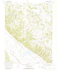
Editions of this 1970 Renault Map
2 editions found
Other maps of this area

1910 · Waterloo
USGS Topo · 1:62,500

1912 · Kimmswick
USGS Topo · 1:62,500

1913 · Waterloo
USGS Topo · 1:62,500

1915 · Renault
USGS Topo · 1:62,500

1915 · Crystal City
USGS Topo · 1:62,500

1916 · Kimmswick
USGS Topo · 1:62,500

1940 · Renault
USGS Topo · 1:62,500

1948 · Kimmswick
USGS Topo · 1:62,500

1949 · Saint Louis
USGS Topo · 1:250,000

1949 · Crystal City
USGS Topo · 1:62,500