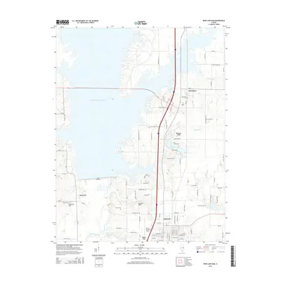
2015 Map of Rend Lake Dam
USGS Topo · Published 2015About this map
Benton and its northwestern neighbors sit at the edge of a landscape transformed by water management and regional infrastructure. The massive footprint of the Rend Lake Dam defines the western portion of this 2015 study, which also captures the Mine Number 21 Reservoir and several smaller water bodies like Lake Benton and Lake Hamilton. This era reflects the modern character of Franklin County, where the industrial legacy of the Big Muddy coal field is visible in names like Mine 24 Rd and Mine Spur Ln.
Find a feature on this map
96 named features on this map. Tap any name to fly to it.
Don’t see what you’re looking for? This feature index may not catch every label — zoom into the map to look around manually.
Map Details
Editions of this 2015 Rend Lake Dam Map
This is the sole edition of this map. No revisions or reprints were ever made.
Other maps of this area

1909 · West Frankfort
USGS Topo · 1:62,500

1910 · Herrin
USGS Topo · 1:62,500

1926 · Duquoin
USGS Topo · 1:62,500

1936 · Herrin
USGS Topo · 1:62,500

1939 · Ina
USGS Topo · 1:62,500

1941 · West Frankfort
USGS Topo · 1:62,500

1943 · Ina
USGS Topo · 1:62,500

1949 · Paducah
USGS Topo · 1:250,000

1950 · Paducah
USGS Topo · 1:250,000

1954 · Paducah
USGS Topo · 1:250,000