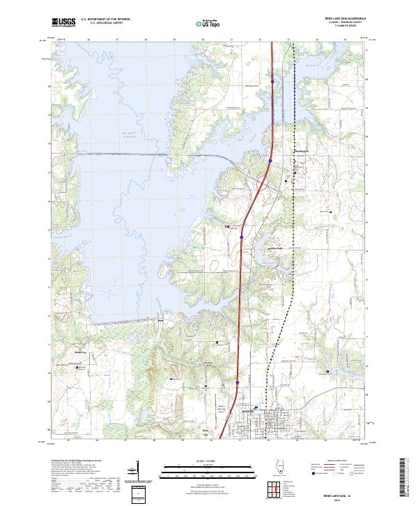
2024 Map of Rend Lake Dam
USGS Topo · Published 2024About this map
Benton and its western neighbor West City anchor the southern portion of this map, illustrating the modern expansion of these Franklin County communities near the Big Muddy River. The landscape is dominated by the sprawling impoundment of Rend Lake, with notable shore features like Bluebell Bluff and the low-lying wetlands around Gun Creek. This survey reveals a high density of small family and community burial grounds, including Winemiller Cem, Moser Cem, and Shiloh Cem, which offer significant value for genealogical research in this part of Illinois.
Find a feature on this map
116 named features on this map. Tap any name to fly to it.
Don’t see what you’re looking for? This feature index may not catch every label — zoom into the map to look around manually.
Map Details
Editions of this 2024 Rend Lake Dam Map
This is the sole edition of this map. No revisions or reprints were ever made.
Other maps of this area

1909 · West Frankfort
USGS Topo · 1:62,500

1910 · Herrin
USGS Topo · 1:62,500

1926 · Duquoin
USGS Topo · 1:62,500

1936 · Herrin
USGS Topo · 1:62,500

1939 · Ina
USGS Topo · 1:62,500

1941 · West Frankfort
USGS Topo · 1:62,500

1943 · Ina
USGS Topo · 1:62,500

1949 · Paducah
USGS Topo · 1:250,000

1950 · Paducah
USGS Topo · 1:250,000

1954 · Paducah
USGS Topo · 1:250,000