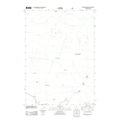
2012 Map of Rendezvous Peak
USGS Topo · Published 2012About this map
Wilson sits at the southeastern edge of this high-altitude landscape, where the valley floor meets the steep rise of the Teton Range. The map reveals a complex network of alpine drainage systems, including Moose Cr and the various forks of Granite Cr, which carve through the high peaks and basins. Significant topographical landmarks such as Rendezvous Peak and Rendezvous Mountain dominate the eastern portion, while Mount Glory and Phillips Pass provide critical passage points across the ridgelines. This 2012 survey illustrates the modern configuration of recreational and wilderness areas, from the Coal Creek Campground to remote features like Marion Lake and Ski Lake. The presence of named alpine meadows like Moose Meadows and Coal Creek Meadows indicates the seasonal grazing and wildlife habitat patterns characteristic of these high-elevation ecosystems, preserved here in precise detail.
Find a feature on this map
28 named features on this map. Tap any name to fly to it.
Don’t see what you’re looking for? This feature index may not catch every label — zoom into the map to look around manually.
Map Details
Editions of this 2012 Rendezvous Peak Map
This is the sole edition of this map. No revisions or reprints were ever made.
Other maps of this area

1899 · Grand Teton
USGS Topo · 1:125,000

1901 · Grand Teton
USGS Topo · 1:125,000

1931 · Jackson
USGS Topo · 1:125,000

1932 · Irwin
USGS Topo · 1:96,000

1935 · Irwin
USGS Topo · 1:125,000

1935 · Jackson
USGS Topo · 1:125,000

1943 · Driggs
USGS Topo · 1:62,500

1946 · Driggs
USGS Topo · 1:62,500

1955 · Driggs
USGS Topo · 1:250,000

1958 · Driggs
USGS Topo · 1:250,000