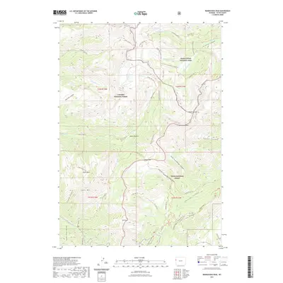
2021 Map of Rendezvous Peak
USGS Topo · Published 2021About this map
Rendezvous Peak and the surrounding high-altitude terrain define this 2021 study of the Teton region, where the boundaries of Grand Teton National Park, Targhee National Forest, and Teton National Forest converge. The landscape is a network of named drainages like Granite Canyon and Jensen Canyon, carved between prominent summits such as Housetop Mtn and Taylor Mtn. A sophisticated system of trails, including the Teton Crest Trl and Phillips Ridge Trl, connects landmarks like the remote Marion Lake and the natural clearing at Moose Meadows. The presence of the Glory Slide near Mt Glory and the seasonal waters of Ski Lake highlight the area's physical geography. This survey provides a modern record of established backcountry routes, including the Mail Cabin Trl and Snotel Trl, illustrating how human passage is funneled through natural gaps like Phillips Pass.
Find a feature on this map
59 named features on this map. Tap any name to fly to it.
Don’t see what you’re looking for? This feature index may not catch every label — zoom into the map to look around manually.
Map Details
Editions of this 2021 Rendezvous Peak Map
This is the sole edition of this map. No revisions or reprints were ever made.
Other maps of this area

1899 · Grand Teton
USGS Topo · 1:125,000

1901 · Grand Teton
USGS Topo · 1:125,000

1931 · Jackson
USGS Topo · 1:125,000

1932 · Irwin
USGS Topo · 1:96,000

1935 · Irwin
USGS Topo · 1:125,000

1935 · Jackson
USGS Topo · 1:125,000

1943 · Driggs
USGS Topo · 1:62,500

1946 · Driggs
USGS Topo · 1:62,500

1955 · Driggs
USGS Topo · 1:250,000

1958 · Driggs
USGS Topo · 1:250,000