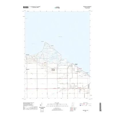
2019 Map of Reno Beach
USGS Topo · Published 2019About this map
The western edge of Lake Erie defines this coastal landscape where Maumee Bay meets the wetlands and low-lying plains of eastern Lucas County. The shoreline is characterized by a series of distinct ponds and bays, including Pintail Pond, Widgeon Pond, and Secor Bay, separated from the open lake by the narrow profile of Cedar Point and Lamb Beach. This area is a critical environment for waterfowl and conservation, anchored by the Mallard Club Marsh and the Cedar Point Marsh. Small coastal settlements and neighborhoods like Reno Beach, Niles Beach, and Lakemont Landing are connected by a network of drainage infrastructure, such as Sautter Ditch and Wards Canal, which manage the water levels of this naturally marshy terrain. Inland, the community of Bono sits near the southern edge of the quadrangle, serving as a hub for the surrounding agricultural and wetland district.
Find a feature on this map
79 named features on this map. Tap any name to fly to it.
Don’t see what you’re looking for? This feature index may not catch every label — zoom into the map to look around manually.
Map Details
Editions of this 2019 Reno Beach Map
This is the sole edition of this map. No revisions or reprints were ever made.
Other maps of this area

1900 · Maumee Bay
USGS Topo · 1:62,500

1900 · Oak Harbor
USGS Topo · 1:62,500

1912 · Monroe
USGS Topo · 1:62,500

1914 · Monroe
USGS Topo · 1:62,500

1934 · Reno Beach
USGS Topo · 1:24,000

1934 · Point Place
USGS Topo · 1:24,000

1935 · Walbridge
USGS Topo · 1:24,000

1935 · Genoa
USGS Topo · 1:24,000
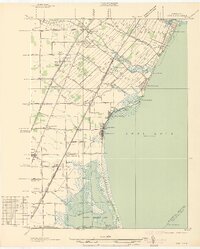
1936 · Erie
USGS Topo · 1:31,680

1938 · Walbridge
USGS Topo · 1:31,680