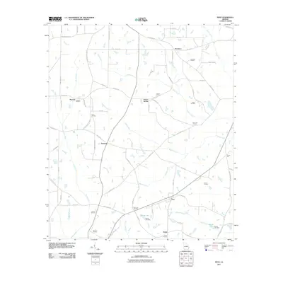
2011 Map of Reno
USGS Topo · Published 2011About this map
Reno and its surrounding countryside in Grady County are defined by a network of creeks and small family cemeteries that testify to the area's deep-rooted agricultural lineage. Tributaries like Tired Creek and Sofkee Creek weave through the landscape, dictating the placement of early settlements and road crossings. Small community hubs including Nickleville, Orange Springs, and Providence are scattered across the quadrangle, often anchored by historic burial grounds. Genealogists will find a wealth of data points here, as the landscape is dotted with sites like Walden Cemetery, Sasser Cemetery, and Saint Luke Cemetery. The southern reaches are marked by more modern water management features such as Gainey Lake Dam and Harold Lake Dam, which contrast with the older rural patterns of Magnolia and the strangely named Princes Still. This landscape reflects a late 20th-century transition, where traditional farming homesteads remain central to the geography of southern Georgia.
Find a feature on this map
73 named features on this map. Tap any name to fly to it.
Don’t see what you’re looking for? This feature index may not catch every label — zoom into the map to look around manually.
Map Details
Editions of this 2011 Reno Map
This is the sole edition of this map. No revisions or reprints were ever made.
Other maps of this area

1954 · Tallahassee
USGS Topo · 1:250,000

1955 · Whigham
USGS Topo · 1:62,500

1956 · Havana North
USGS Topo · 1:24,000

1956 · Cairo
USGS Topo · 1:62,500

1956 · Calvary
USGS Topo · 1:24,000

1957 · Beachton
USGS Topo · 1:24,000

1959 · Tallahassee
USGS Topo · 1:250,000

1960 · Tallahassee
USGS Topo · 1:250,000
1974 · Whigham
USGS Topo · 1:24,000
1974 · Climax North
USGS Topo · 1:24,000