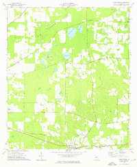
1974 Map of Climax North
USGS Topo · Published 1976About this map
The town of Climax anchors this 1974 survey of southwest Georgia, situated at a junction along the Seaboard Coast Line. This rural landscape is defined by its small community centers and numerous country houses of worship, ranging from Adams Chapel in the west to Grant Chapel and Salem Ch in the central corridor. The topography is marked by a series of prominent depressions and basins, including Open Pond, Cane Water Pond, and Black Lake, while the Big Slough meanders through the northwest corner of the county.
Find a feature on this map
28 named features on this map. Tap any name to fly to it.
Don’t see what you’re looking for? This feature index may not catch every label — zoom into the map to look around manually.
Map Details
Editions of this 1974 Climax North Map
This is the sole edition of this map. No revisions or reprints were ever made.
Other maps of this area

1953 · Dothan
USGS Topo · 1:250,000

1954 · Dothan
USGS Topo · 1:250,000

1954 · Tallahassee
USGS Topo · 1:250,000

1955 · Dothan
USGS Topo · 1:250,000

1955 · Bainbridge
USGS Topo · 1:62,500

1955 · Whigham
USGS Topo · 1:62,500

1959 · Tallahassee
USGS Topo · 1:250,000

1960 · Tallahassee
USGS Topo · 1:250,000

1971 · Gee Pond
USGS Topo · 1:24,000

1971 · Vada
USGS Topo · 1:24,000