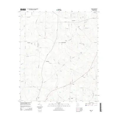
2014 Map of Reno
USGS Topo · Published 2014About this map
Reno and the surrounding rural landscape of Grady County are defined by a network of small settlements and family-linked burial grounds. The community of Nickleville sits near the center of this 2014 survey, positioned among the headwaters of Maxwell Cr and Tired Creek Rd. The area's genealogical depth is visible in the numerous cemeteries that dot the countryside, including the Saint Luke Cem near the intersection of Ga-111 and the Harrison Cem further west.
Find a feature on this map
98 named features on this map. Tap any name to fly to it.
Don’t see what you’re looking for? This feature index may not catch every label — zoom into the map to look around manually.
Map Details
Editions of this 2014 Reno Map
This is the sole edition of this map. No revisions or reprints were ever made.
Other maps of this area

1954 · Tallahassee
USGS Topo · 1:250,000

1955 · Whigham
USGS Topo · 1:62,500

1956 · Havana North
USGS Topo · 1:24,000

1956 · Cairo
USGS Topo · 1:62,500

1956 · Calvary
USGS Topo · 1:24,000

1957 · Beachton
USGS Topo · 1:24,000

1959 · Tallahassee
USGS Topo · 1:250,000

1960 · Tallahassee
USGS Topo · 1:250,000
1974 · Whigham
USGS Topo · 1:24,000
1974 · Climax North
USGS Topo · 1:24,000