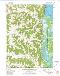
1980 Map of Reno
USGS Topo · Published 1980About this map
Richard J Dorer Memorial Hardwood State Forest dominates the high, wooded ridges of Houston County, where the driftless area terrain drops sharply toward the river valley. Along the eastern edge, the Chicago Milwaukee St Paul and Pacific railroad tracks follow the narrow bench between the bluffs and the extensive wetlands of the Upper Mississippi River Wild Life and Fish Refuge. Small settlements and agricultural pockets are tucked into the valleys of Crooked Creek and Winnebago Creek, including the community of Freeburg and the hamlet of Reno.
Find a feature on this map
41 named features on this map. Tap any name to fly to it.
Don’t see what you’re looking for? This feature index may not catch every label — zoom into the map to look around manually.
Map Details
Editions of this 1980 Reno Map
This is the sole edition of this map. No revisions or reprints were ever made.
Other maps of this area

1903 · Waukon
USGS Topo · 1:125,000

1926 · Stoddard
USGS Topo · 1:62,500

1929 · Ferryville
USGS Topo · 1:62,500

1932 · Ferryville
USGS Topo · 1:62,500

1956 · Brownsville
USGS Topo · 1:62,500

1958 · La Crosse
USGS Topo · 1:250,000

1961 · La Crosse
USGS Topo · 1:250,000

1965 · La Crosse
USGS Topo · 1:250,000
1965 · Stoddard
USGS Topo · 1:62,500

1966 · Ferryville
USGS Topo · 1:62,500