
1974 Map of Reno Junction
USGS Topo · Published 1975About this map
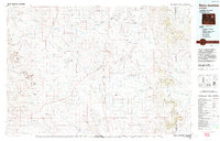
The Hilight Oil and Gas Field and its neighboring Payne Oil and Gas Field dominate the eastern landscape of this Wyoming map, reflecting the mid-1970s energy landscape in the Powder River Basin. The terrain is characterized by a network of drainage systems like Pumpkin Creek and Porcupine Creek, punctuated by prominent landmarks such as North Middle Butte and South Middle Butte. Small settlements and ranching hubs, including Reno Junction and Savageton, serve as the primary human outposts in a territory otherwise defined by wide-open slopes and petroleum infrastructure.
Find a feature on this map
81 named features on this map. Tap any name to fly to it.
Don’t see what you’re looking for? This feature index may not catch every label — zoom into the map to look around manually.
Map Details
Editions of this 1974 Reno Junction Map
2 editions found
Other maps of this area

1918 · Moorcroft
USGS Topo · 1:125,000

1953 · Dry Fork Ranch
USGS Topo · 1:24,000

1953 · Fort Reno SE
USGS Topo · 1:24,000

1953 · Savageton
USGS Topo · 1:24,000

1953 · Fats Draw
USGS Topo · 1:24,000

1953 · South Butte
USGS Topo · 1:24,000

1953 · The Nipple
USGS Topo · 1:24,000

1953 · Rolling Pin Ranch
USGS Topo · 1:24,000

1953 · North Butte
USGS Topo · 1:24,000

1954 · Artesian Draw
USGS Topo · 1:24,000