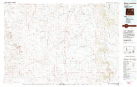
1974 Map of Reno Junction
USGS Topo · Published 1993About this map
The Belle Fourche River headwaters and the vast energy landscapes of the Powder River Basin define this mid-1970s survey. The map centers on the critical energy hub at Reno Junction, where the intersection of State Routes 59 and 387 served as a gateway to the expanding Hilight Oil and Gas Field and Wild Horse Slope Oil and Gas Field. The settlement of Reno sits near the Flats, an area marked by a complex network of ephemeral drainages like All Night Creek and Fourmile Creek.
Find a feature on this map
65 named features on this map. Tap any name to fly to it.
Don’t see what you’re looking for? This feature index may not catch every label — zoom into the map to look around manually.
Map Details
Editions of this 1974 Reno Junction Map
2 editions found

Other maps of this area

1918 · Moorcroft
USGS Topo · 1:125,000

1953 · Dry Fork Ranch
USGS Topo · 1:24,000

1953 · Fort Reno SE
USGS Topo · 1:24,000

1953 · Savageton
USGS Topo · 1:24,000

1953 · Fats Draw
USGS Topo · 1:24,000

1953 · South Butte
USGS Topo · 1:24,000

1953 · The Nipple
USGS Topo · 1:24,000

1953 · Rolling Pin Ranch
USGS Topo · 1:24,000

1953 · North Butte
USGS Topo · 1:24,000

1954 · Artesian Draw
USGS Topo · 1:24,000