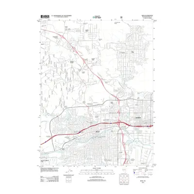
2012 Map of Reno
USGS Topo · Published 2012About this map
Reno and Sparks dominate the landscape of this 2012 survey, showing the complex urban footprint of northwestern Nevada. The map captures the significant role of institutional and transportation infrastructure, from the expansive University of Nevada campus and its Experimental Farm to the Cannon International Airport and the prominent Round House near the rail lines in Sparks. The Truckee River flows through the heart of the city, passing Scott Island and Virginia Lake, while the irrigation history of the region is evidenced by the Prosser Valley Ditch.
Find a feature on this map
65 named features on this map. Tap any name to fly to it.
Don’t see what you’re looking for? This feature index may not catch every label — zoom into the map to look around manually.
Map Details
Editions of this 2012 Reno Map
This is the sole edition of this map. No revisions or reprints were ever made.
Other maps of this area

1891 · Carson
USGS Topo · 1:125,000

1891 · Reno
USGS Topo · 1:125,000

1893 · Carson
USGS Topo · 1:125,000

1893 · Reno
USGS Topo · 1:125,000

1950 · Virginia City
USGS Topo · 1:62,500

1950 · Mt. Rose
USGS Topo · 1:62,500

1950 · Reno
USGS Topo · 1:62,500

1951 · Reno
USGS Topo · 1:62,500

1952 · Mt. Rose
USGS Topo · 1:62,500

1952 · Virginia City
USGS Topo · 1:62,500