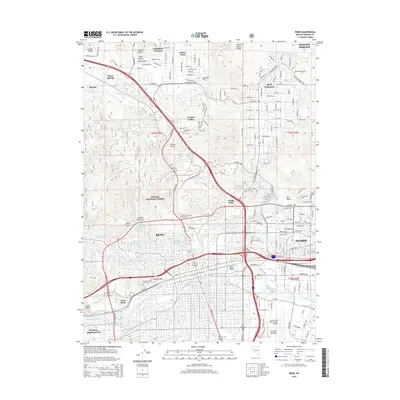
2015 Map of Reno
USGS Topo · Published 2015About this map
The Truckee River corridor serves as the central anchor for this detailed 2015 study of the Nevada high desert. The landscape is defined by the sharp transition between the dense urban grid of Reno and Sparks and the steep, rising terrain of Peavine Mountain to the west. Irrigation history is visible through a complex network of man-made waterways like the Highland Ditch, Orr Ditch, and Pioneer Ditch, which historically supported the valley's development. North of the city, residential expansion is evident in Sun Valley and Panther Valley, which are situated between the peaks of the Toiyabe National Forest and the Junction House Range. Prominent institutions and landmarks are clearly mapped, including the Univ of Nevada-Reno campus, Manzanita Lake, and the expansive Reno/Tahoe International Airport in the south, while local history can be traced through sites like Mother of Sorrows Cemetery and Mountain View Cemetery.
Find a feature on this map
193 named features on this map. Tap any name to fly to it.
Don’t see what you’re looking for? This feature index may not catch every label — zoom into the map to look around manually.
Map Details
Editions of this 2015 Reno Map
This is the sole edition of this map. No revisions or reprints were ever made.
Other maps of this area

1891 · Carson
USGS Topo · 1:125,000

1891 · Reno
USGS Topo · 1:125,000

1893 · Carson
USGS Topo · 1:125,000

1893 · Reno
USGS Topo · 1:125,000

1950 · Virginia City
USGS Topo · 1:62,500

1950 · Mt. Rose
USGS Topo · 1:62,500

1950 · Reno
USGS Topo · 1:62,500

1951 · Reno
USGS Topo · 1:62,500

1952 · Mt. Rose
USGS Topo · 1:62,500

1952 · Virginia City
USGS Topo · 1:62,500