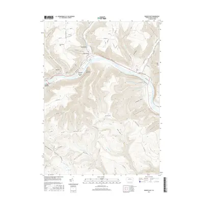
2016 Map of Renovo East
USGS Topo · Published 2016About this map
South Renovo and its neighboring riverfront settlements occupy a narrow corridor along the West Branch Susquehanna River as it cuts through the Allegheny Mountains. The 2016 landscape reflects a community built on the river's edge, with Renovo and Farwell situated near the historic crossing points of the waterway. Notable local landmarks include Fairview Cem overlooking the valley and the distinctive Tamarack Island mid-river.
Find a feature on this map
89 named features on this map. Tap any name to fly to it.
Don’t see what you’re looking for? This feature index may not catch every label — zoom into the map to look around manually.
Map Details
Editions of this 2016 Renovo East Map
This is the sole edition of this map. No revisions or reprints were ever made.
Other maps of this area

1921 · Howard
USGS Topo · 1:48,000

1923 · Howard
USGS Topo · 1:62,500

1928 · Snow Shoe
USGS Topo · 1:48,000

1931 · Show Shoe
USGS Topo · 1:62,500

1943 · Hyner
USGS Topo · 1:62,500

1946 · Young Womans Creek
USGS Topo · 1:24,000

1946 · Renovo East
USGS Topo · 1:62,500

1946 · Renovo West
USGS Topo · 1:62,500

1946 · Tamarack
USGS Topo · 1:24,000

1946 · Slate Run
USGS Topo · 1:24,000
Featured Places
- South Renovo, PA
- Farwell, Chapman Township
- Little Italee, Chapman Township
- Noyes Township, PA
- Chapman Township, PA