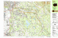
1983 Map of Renton
USGS Topo · Published 1983About this map
The Cedar River carves a deep valley through this King County landscape, separating the industrial centers of Renton and Tukwila from the rising foothills to the east. By the early 1980s, suburban expansion is evident in the residential clustering at Benson Hill and Fairwood, though the protected Lake Youngs Watershed remains a massive, undeveloped anchor in the center of the sheet. The map documents a complex infrastructure of transit and recreation, featuring the Municipal Airport, the Burlington Northern rail lines, and numerous local institutions like Greenwood Cem and Highlands Community Ch. From the riverside settlements of Elliott and Maplewood to the more secluded enclaves of Dorre Don and Arcadia, the topography shifts from the developed alluvial plains of Springbrook Creek to the steep slopes of Cedar Mtn and Squak Mtn.
Find a feature on this map
90 named features on this map. Tap any name to fly to it.
Don’t see what you’re looking for? This feature index may not catch every label — zoom into the map to look around manually.
Map Details
Editions of this 1983 Renton Map
This is the sole edition of this map. No revisions or reprints were ever made.
Other maps of this area

1894 · Seattle
USGS Topo · 1:62,500

1895 · Snohomish
USGS Topo · 1:125,000

1897 · Tacoma
USGS Topo · 1:125,000

1897 · Seattle
USGS Topo · 1:125,000

1900 · Tacoma
USGS Topo · 1:125,000

1908 · Seattle
USGS Topo · 1:62,500

1909 · Seattle Special
USGS Topo · 1:62,500

1913 · Cedar Lake
USGS Topo · 1:125,000

1921 · Sultan
USGS Topo · 1:125,000

1923 · Sultan
USGS Topo · 1:125,000