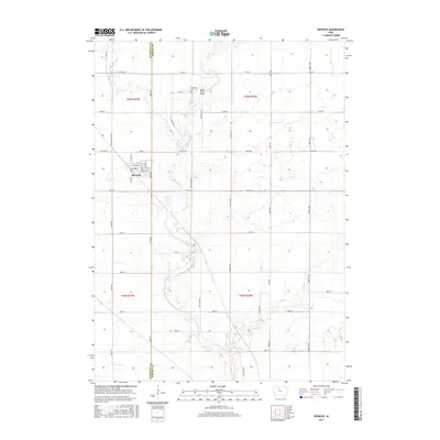
2015 Map of Renwick
USGS Topo · Published 2015About this map
The town of Renwick serves as the central hub of this agricultural landscape in north-central Iowa, situated along the border of Humboldt and Wright Counties. The settlement is defined by its grid of streets, including Main St and Martin St, and is flanked by the Boone River as it meanders southward. This riparian corridor provides a distinct contrast to the surrounding section-line road network, where routes like York Ave and Emmett Ave carve the terrain into neat parcels for farming. To the north, Elmwood Cem sits near the river's path, while the southern reaches are marked by the confluence of Otter Cr and Prairie Creek. The map reflects a modern rural economy reliant on high-capacity county highways, such as Co Hwy P76 and Co Rd C26, which connect these farmstead-dotted townships.
Find a feature on this map
40 named features on this map. Tap any name to fly to it.
Don’t see what you’re looking for? This feature index may not catch every label — zoom into the map to look around manually.
Map Details
Editions of this 2015 Renwick Map
This is the sole edition of this map. No revisions or reprints were ever made.
Other maps of this area

1923 · Fort Dodge
USGS Topo · 1:62,500

1954 · Waterloo
USGS Topo · 1:250,000

1954 · Fort Dodge
USGS Topo · 1:250,000

1955 · Waterloo
USGS Topo · 1:250,000

1957 · Fort Dodge
USGS Topo · 1:250,000

1958 · Fort Dodge
USGS Topo · 1:250,000

1972 · Kanawha SE
USGS Topo · 1:24,000

1972 · Corwith
USGS Topo · 1:24,000

1972 · Kanawha
USGS Topo · 1:24,000

1972 · Renwick
USGS Topo · 1:24,000