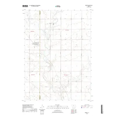
2018 Map of Renwick
USGS Topo · Published 2018About this map
Renwick serves as the primary hub of this North Central Iowa landscape, situated along the border of Humboldt Co and Wright Co. The town's grid is centered around Main St and Stoddard St, with several family-named avenues extending into the surrounding agricultural sections. The waterway network is dominated by the Boone River, which flows southward through the center of the quadrangle, joined by tributaries like Prairie Creek and Otter Cr. This 2018 survey reveals a terrain defined by its section-line roads, such as York Ave and Calhoun Ave, which create a precise geometric pattern across the river valley. Notable local landmarks include the Boone River Bridge and Elmwood Cem, providing specific points of interest for genealogists and local historians tracking the development of these rural townships.
Find a feature on this map
41 named features on this map. Tap any name to fly to it.
Don’t see what you’re looking for? This feature index may not catch every label — zoom into the map to look around manually.
Map Details
Editions of this 2018 Renwick Map
This is the sole edition of this map. No revisions or reprints were ever made.
Other maps of this area

1923 · Fort Dodge
USGS Topo · 1:62,500

1954 · Waterloo
USGS Topo · 1:250,000

1954 · Fort Dodge
USGS Topo · 1:250,000

1955 · Waterloo
USGS Topo · 1:250,000

1957 · Fort Dodge
USGS Topo · 1:250,000

1958 · Fort Dodge
USGS Topo · 1:250,000

1972 · Kanawha SE
USGS Topo · 1:24,000

1972 · Corwith
USGS Topo · 1:24,000

1972 · Kanawha
USGS Topo · 1:24,000

1972 · Renwick
USGS Topo · 1:24,000