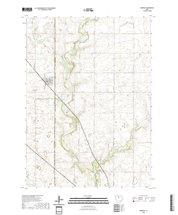
2022 Map of Renwick
USGS Topo · Published 2022About this map
Renwick serves as the primary hub of this North Central Iowa landscape, situated at the intersection of N Smith St and Main St. The town's grid is bisected by the county line separating Humboldt Co and Wright Co, providing a clear view of how jurisdictional boundaries influenced local settlement. To the north, Elmwood Cem marks a significant site for genealogical research, while the meandering path of the Boone River dominates the central terrain. This river, along with tributaries like Prairie Creek and Otter Cr, dictates the rural road network, which shifts from the rigid township grid to follow the natural contours of the waterways. The presence of Co Hwy P76 (Xenia) suggests a connection to older naming conventions and vanished locales in this agricultural region.
Find a feature on this map
38 named features on this map. Tap any name to fly to it.
Don’t see what you’re looking for? This feature index may not catch every label — zoom into the map to look around manually.
Map Details
Editions of this 2022 Renwick Map
This is the sole edition of this map. No revisions or reprints were ever made.
Other maps of this area

1923 · Fort Dodge
USGS Topo · 1:62,500

1954 · Waterloo
USGS Topo · 1:250,000

1954 · Fort Dodge
USGS Topo · 1:250,000

1955 · Waterloo
USGS Topo · 1:250,000

1957 · Fort Dodge
USGS Topo · 1:250,000

1958 · Fort Dodge
USGS Topo · 1:250,000

1972 · Kanawha SE
USGS Topo · 1:24,000

1972 · Corwith
USGS Topo · 1:24,000

1972 · Kanawha
USGS Topo · 1:24,000

1972 · Renwick
USGS Topo · 1:24,000