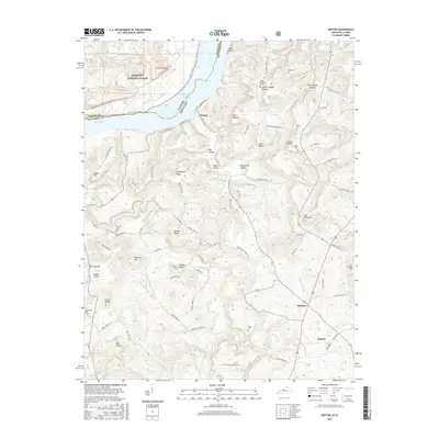
2016 Map of Repton
USGS Topo · Published 2016About this map
Weston sits along the southern bank of the Ohio River in this 2016 survey, marking the transition from the riverfront to the upland ridges of Crittenden County. The landscape is defined by the sharp relief of features like Cain Bluff and Duncan Bluff, which rise above the winding paths of Crooked Creek and Camp Cr. In the southern portion of the quadrangle, the small communities of Mattoon and Repton serve as local hubs, connected by a network of rural routes such as Mattoon Loop and Fishtrap Rd. Genealogists will find several burial grounds across the area, including Repton Cem, Walker Cem, and Lamb Cem, often situated near prominent terrain features like Obie Mound or the geologically distinct depression known as The Sinks. The northern section includes a portion of the Shawnee National Forest, reflecting the varied land use between timber, agriculture, and the rural homesteads that dot Daniels Ridge.
Find a feature on this map
100 named features on this map. Tap any name to fly to it.
Don’t see what you’re looking for? This feature index may not catch every label — zoom into the map to look around manually.
Map Details
Editions of this 2016 Repton Map
This is the sole edition of this map. No revisions or reprints were ever made.
Other maps of this area

1907 · Morganfield
USGS Topo · 1:62,500

1909 · Providence
USGS Topo · 1:62,500

1916 · Shawneetown
USGS Topo · 1:62,500

1916 · Fords Ferry
USGS Topo · 1:62,500

1921 · Fords Ferry
USGS Topo · 1:48,000

1925 · Cave In Rock
USGS Topo · 1:62,500

1949 · Paducah
USGS Topo · 1:250,000

1950 · Paducah
USGS Topo · 1:250,000

1951 · Sturgis
USGS Topo · 1:24,000
1953 · Dekoven
USGS Topo · 1:24,000