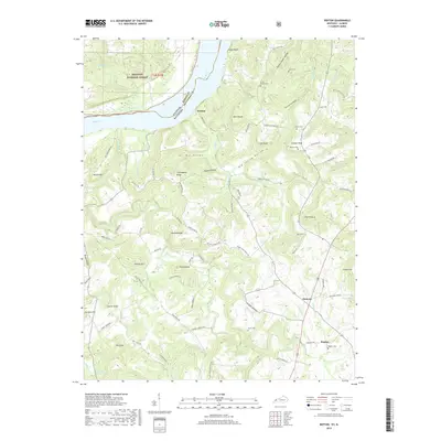
2019 Map of Repton
USGS Topo · Published 2019About this map
The Ohio River serves as a natural boundary between Illinois and Kentucky in this 2019 survey, where the bluffs of Crittenden County meet the water. A diverse landscape of ridges and hollows defines the interior, anchored by small settlements like Mattoon and Repton in the southeast and Weston along the riverfront. The terrain is marked by distinctive karst and geological features, including The Sinks and No Bottom Spring, alongside numerous named elevations such as The Pinnacle and Turkey Knob.
Find a feature on this map
92 named features on this map. Tap any name to fly to it.
Don’t see what you’re looking for? This feature index may not catch every label — zoom into the map to look around manually.
Map Details
Editions of this 2019 Repton Map
This is the sole edition of this map. No revisions or reprints were ever made.
Other maps of this area

1907 · Morganfield
USGS Topo · 1:62,500

1909 · Providence
USGS Topo · 1:62,500

1916 · Shawneetown
USGS Topo · 1:62,500

1916 · Fords Ferry
USGS Topo · 1:62,500

1921 · Fords Ferry
USGS Topo · 1:48,000

1925 · Cave In Rock
USGS Topo · 1:62,500

1949 · Paducah
USGS Topo · 1:250,000

1950 · Paducah
USGS Topo · 1:250,000

1951 · Sturgis
USGS Topo · 1:24,000
1953 · Dekoven
USGS Topo · 1:24,000