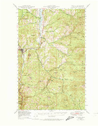
1948 Map of Republic
USGS Topo · Published 1974About this map
The gold-mining center of Republic serves as the focal point for this survey of the northern Okanogan Highlands, where the Great Northern railroad winds along the Sanpoil River and Curlew Lake. The landscape is defined by its industrial and fire-watch infrastructure within the Colville National Forest. Notable operations like the California Mine sit among named peaks such as Klondike Mtn, Gibraltar Mtn, and Gold Hill, reflecting the region's mineral-driven development. Beyond the main townsite, smaller settlements like Pollard and Torboy appear along the rail line, while the high country is dotted with essential wilderness outposts including the 13 Mile Mtn Lookout and Quartz Mtn Lookout. The intricate drainage system of the Sanpoil River, including its North, Middle, and South forks, highlights the topographic complexity that shaped early transport and timber harvesting in Ferry County.
Find a feature on this map
63 named features on this map. Tap any name to fly to it.
Don’t see what you’re looking for? This feature index may not catch every label — zoom into the map to look around manually.
Map Details
Editions of this 1948 Republic Map
2 editions found
Other maps of this area

1904 · Republic
USGS Topo · 1:125,000

1936 · Marcus
USGS Topo · 1:96,000

1942 · Marcus
USGS Topo · 1:125,000

1948 · Curlew
USGS Topo · 1:62,500

1948 · Republic
USGS Topo · 1:62,500

1948 · Sherman Peak
USGS Topo · 1:62,500

1948 · Togo Mountain
USGS Topo · 1:62,500

1951 · Wauconda
USGS Topo · 1:62,500

1951 · Togo Mountain
USGS Topo · 1:62,500

1951 · Sherman Peak
USGS Topo · 1:62,500