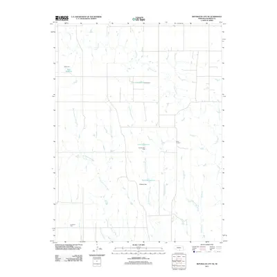
2011 Map of Republican City NE
USGS Topo · Published 2011About this map
The agricultural landscape of Franklin County is defined by a sophisticated network of water management features, as shown in this 2011 United States Geological Survey record. The terrain is bifurcated by several north-south drainage systems, including Center Creek, Little Cottonwood Creek, and the winding Big Cottonwood Creek. These waterways are punctuated by numerous private and utility water works such as Adam Dam, Frerichs Dam, and Phillipson Dam, which created substantial local water bodies like Adam Reservoir and Phillipson Reservoir.
Find a feature on this map
14 named features on this map. Tap any name to fly to it.
Don’t see what you’re looking for? This feature index may not catch every label — zoom into the map to look around manually.
Map Details
Editions of this 2011 Republican City NE Map
This is the sole edition of this map. No revisions or reprints were ever made.
Other maps of this area

1896 · Holdrege
USGS Topo · 1:125,000

1897 · Red Cloud
USGS Topo · 1:125,000

1955 · Grand Island
USGS Topo · 1:250,000

1957 · Grand Island
USGS Topo · 1:250,000

1958 · Grand Island
USGS Topo · 1:250,000

1969 · Upland
USGS Topo · 1:24,000

1970 · Wilcox
USGS Topo · 1:24,000
1970 · Hildreth
USGS Topo · 1:24,000
1973 · Macon
USGS Topo · 1:24,000
1973 · Republican City NE
USGS Topo · 1:24,000