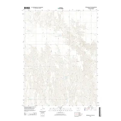
2014 Map of Republican City NE
USGS Topo · Published 2014About this map
Bailey Cem sits along the eastern edge of this agricultural landscape in Franklin County, serving as a quiet landmark amidst a grid of rural section lines. The terrain is defined by the drainage systems of Center Cr and several namesake reservoirs that support the local farming economy. Frerichs Reservoir and Adam Reservoir capture runoff in the northern reaches, while Phillipson Reservoir and Anderson Reservoir are situated further south. A dense network of local roads, including Ridge Rd and several numbered routes, facilitates movement across the rolling prairie. The map details the intricate branching of Big Cottonwood Cr and Little Cottonwood Cr as they carve through the Republican River watershed, illustrating the essential relationship between water management and Great Plains land use in the early 21st century.
Find a feature on this map
28 named features on this map. Tap any name to fly to it.
Don’t see what you’re looking for? This feature index may not catch every label — zoom into the map to look around manually.
Map Details
Editions of this 2014 Republican City NE Map
This is the sole edition of this map. No revisions or reprints were ever made.
Other maps of this area

1896 · Holdrege
USGS Topo · 1:125,000

1897 · Red Cloud
USGS Topo · 1:125,000

1955 · Grand Island
USGS Topo · 1:250,000

1957 · Grand Island
USGS Topo · 1:250,000

1958 · Grand Island
USGS Topo · 1:250,000

1969 · Upland
USGS Topo · 1:24,000

1970 · Wilcox
USGS Topo · 1:24,000
1970 · Hildreth
USGS Topo · 1:24,000
1973 · Macon
USGS Topo · 1:24,000
1973 · Republican City NE
USGS Topo · 1:24,000