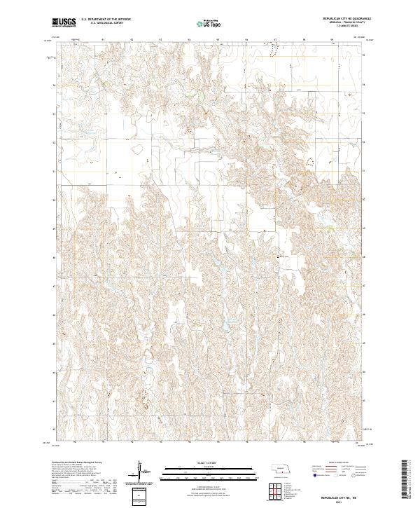
2021 Map of Republican City NE
USGS Topo · Published 2021About this map
Bailey Cem provides a central historical landmark within this section of Franklin County, reflecting the deep roots of the local farming community. The landscape is defined by the drainage patterns of Big Cottonwood Cr and Center Cr, which carve through the plains. Man-made water management is evident in several irrigation and livestock catchments, most notably Adam Reservoir, Phillipson Reservoir, and two distinct sites labeled Frerichs Reservoir. The terrain is organized by a strict grid of section lines, with many of the local routes, such as Ridge Rd and R Rd, following the boundaries of the Public Land Survey System townships t3n r16w and t2n r15w. This 2021 survey demonstrates the enduring agricultural layout of the Nebraska plains, where large-scale farming and water conservation remain the primary drivers of the rural infrastructure.
Find a feature on this map
29 named features on this map. Tap any name to fly to it.
Don’t see what you’re looking for? This feature index may not catch every label — zoom into the map to look around manually.
Map Details
Editions of this 2021 Republican City NE Map
This is the sole edition of this map. No revisions or reprints were ever made.
Other maps of this area

1896 · Holdrege
USGS Topo · 1:125,000

1897 · Red Cloud
USGS Topo · 1:125,000

1955 · Grand Island
USGS Topo · 1:250,000

1957 · Grand Island
USGS Topo · 1:250,000

1958 · Grand Island
USGS Topo · 1:250,000

1969 · Upland
USGS Topo · 1:24,000

1970 · Wilcox
USGS Topo · 1:24,000
1970 · Hildreth
USGS Topo · 1:24,000
1973 · Macon
USGS Topo · 1:24,000
1973 · Republican City NE
USGS Topo · 1:24,000