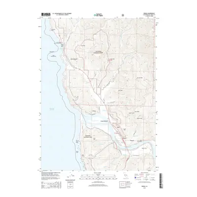
2015 Map of Requa
USGS Topo · Published 2015About this map
The Klamath River meets the Pacific Ocean in this coastal survey, where the river's final bend carves a path through the steep terrain of the Redwood National Park and Six Rivers National Forest. Settlement is concentrated near the river mouth, with Requa perched on the northern bank and Camp Klamath situated just upstream. To the south, the community of Klamath and the settlement of Hoppaw sit near Waukell Flat. The coastal topography is defined by dramatic sea stacks and headlands, including False Klamath Rock and Flint Rock Head, while the Louis P DeMartin Senior Memorial Bridge provides the primary crossing over the lower river. Inland, numerous ridges like Mynot Ridge and Pou-Oup Ridge rise sharply from the water's edge, reflecting the verticality of this northern California landscape.
Find a feature on this map
57 named features on this map. Tap any name to fly to it.
Don’t see what you’re looking for? This feature index may not catch every label — zoom into the map to look around manually.
Map Details
Editions of this 2015 Requa Map
This is the sole edition of this map. No revisions or reprints were ever made.
Other maps of this area

1922 · Preston Peak
USGS Topo · 1:125,000

1925 · Hoopa
USGS Topo · 1:125,000

1929 · Crescent City
USGS Topo · 1:125,000

1945 · Ship Mountain
USGS Topo · 1:62,500

1945 · Orick
USGS Topo · 1:62,500

1945 · Requa
USGS Topo · 1:62,500

1945 · Tectah Creek
USGS Topo · 1:62,500

1948 · Weed
USGS Topo · 1:250,000

1949 · Eureka
USGS Topo · 1:250,000

1950 · Weed
USGS Topo · 1:250,000