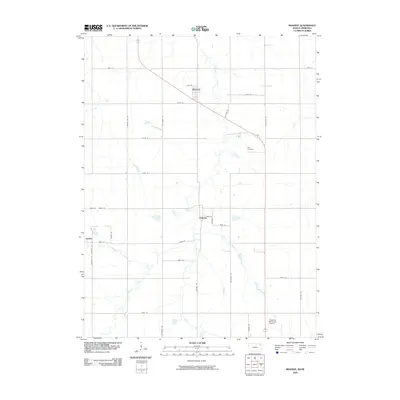
2009 Map of Reserve
USGS Topo · Published 2009About this map
Walnut Creek and its various tributaries, including Terrapin Creek and Euchre Creek, carve through the agricultural landscape of northern Brown County along the Kansas-Nebraska border. The small settlements of Reserve and Padonia serve as focal points for this rural community, situated amidst a dense grid of named country roads such as Jack Rabbit Rd and Killdeer Rd. This 2009 survey highlights a classic Midwestern land-use pattern where the rectilinear township and range system dictates the placement of nearly every road and property boundary, occasionally interrupted by the winding paths of Spring Branch and the steady diagonal of the primary highway. Near the southern edge, the Hiawatha Municipal Airport and Hart Cemetery provide important local landmarks for genealogists and regional researchers documenting this portion of the Great Plains.
Find a feature on this map
32 named features on this map. Tap any name to fly to it.
Don’t see what you’re looking for? This feature index may not catch every label — zoom into the map to look around manually.
Map Details
Editions of this 2009 Reserve Map
This is the sole edition of this map. No revisions or reprints were ever made.
Other maps of this area

1885 · Atchison
USGS Topo · 1:125,000

1888 · Atchison
USGS Topo · 1:125,000

1888 · Hiawatha
USGS Topo · 1:125,000

1893 · Atchison
USGS Topo · 1:125,000

1894 · Hiawatha
USGS Topo · 1:125,000

1915 · Falls City
USGS Topo · 1:62,500

1920 · Craig
USGS Topo · 1:62,500

1950 · Kansas City
USGS Topo · 1:250,000

1954 · Kansas City
USGS Topo · 1:250,000

1955 · Nebraska City
USGS Topo · 1:250,000