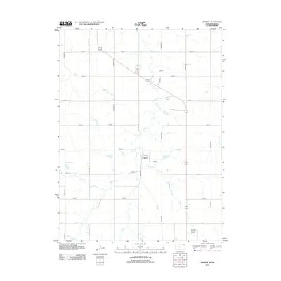
2012 Map of Reserve
USGS Topo · Published 2012About this map
Walnut Cr and its various tributaries, including Terrapin Cr and Euchre Cr, define the drainage of this northeast Kansas agricultural landscape. The small settlement of Padonia sits centered in the quadrangle, structured around a simple grid including 1st St, 4th St, and Main St. Local heritage is anchored by sites such as Cornelison Cem to the north and Hart Cem situated to the east. The southern edge of the map is dominated by the Hiawatha Municipal Airport, showing the intersection of rural aviation and the traditional township road system. The map reveals a highly regular section-line road network with curiously ornithological names, such as Horned Owl Rd, Jackrabbit Rd, and Killdeer Rd, reflecting a systematic modern nomenclature for the area's thoroughfares.
Find a feature on this map
29 named features on this map. Tap any name to fly to it.
Don’t see what you’re looking for? This feature index may not catch every label — zoom into the map to look around manually.
Map Details
Editions of this 2012 Reserve Map
This is the sole edition of this map. No revisions or reprints were ever made.
Other maps of this area

1885 · Atchison
USGS Topo · 1:125,000

1888 · Atchison
USGS Topo · 1:125,000

1888 · Hiawatha
USGS Topo · 1:125,000

1893 · Atchison
USGS Topo · 1:125,000

1894 · Hiawatha
USGS Topo · 1:125,000

1915 · Falls City
USGS Topo · 1:62,500

1920 · Craig
USGS Topo · 1:62,500

1950 · Kansas City
USGS Topo · 1:250,000

1954 · Kansas City
USGS Topo · 1:250,000

1955 · Nebraska City
USGS Topo · 1:250,000