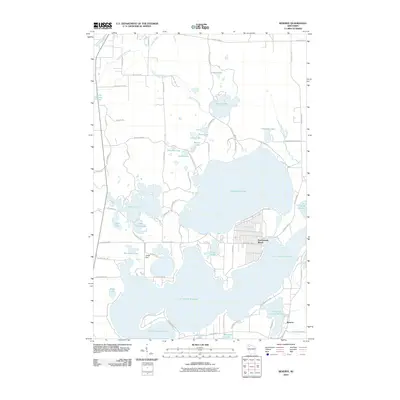
2010 Map of Reserve
USGS Topo · Published 2010About this map
Lac Courte Oreilles and Grindstone Lake dominate this Northwoods landscape, highlighting the water-rich geography of Sawyer County. In the south, the community of Reserve and the more densely gridded residential layout of Northwoods Beach reflect the region's development as a destination for seasonal residence and lakeside recreation. The hydrology is intricate, with smaller bodies of water like Whitefish Lake, Windigo Lake, and Little Lac Courte Oreilles connected by a network of creeks including Spring Lake Creek and Grindstone Creek. The presence of the Jonjak Dam on the western edge of Minnemac Lake points to local water level management, while the Namekagon River clips the northwest corner, signifying the area's importance within the larger St. Croix National Scenic Riverway corridor. A detailed road network, including County Hwy K and County Hwy E, provides access to numerous smaller lakes such as Petty Lake and Adina Lake.
Find a feature on this map
69 named features on this map. Tap any name to fly to it.
Don’t see what you’re looking for? This feature index may not catch every label — zoom into the map to look around manually.
Map Details
Editions of this 2010 Reserve Map
This is the sole edition of this map. No revisions or reprints were ever made.
Other maps of this area

1944 · Couderay
USGS Topo · 1:48,000

1944 · Hayward
USGS Topo · 1:48,000

1947 · Chittamo
USGS Topo · 1:48,000

1948 · Couderay
USGS Topo · 1:48,000

1948 · Stone Lake
USGS Topo · 1:48,000

1949 · Chittamo
USGS Topo · 1:48,000

1950 · Stone Lake
USGS Topo · 1:48,000

1953 · Ashland
USGS Topo · 1:250,000

1953 · Rice Lake
USGS Topo · 1:250,000

1958 · Ashland
USGS Topo · 1:250,000