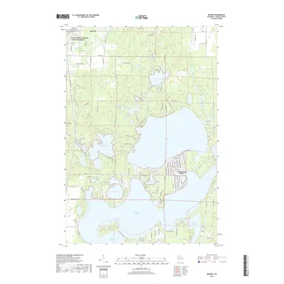
2019 Map of Reserve
USGS Topo · Published 2019About this map
Grindstone Lake and the vast waters of Lac Courte Oreilles dominate this northern Wisconsin landscape, revealing a transition from quiet spring-fed pools to a developed vacation shoreline. Near the community of Northwoods Beach, a dense network of roads like Woodland Rd and Birch Island Rd serves the residential developments along the lakefront. To the north, the geography shifts toward more secluded water bodies, including Windigo Lake and the protective corridor of the Saint Croix National Scenic Riverway near Hayward. Several distinct hydrographic features, such as Graveyard Springs and Upper Grindstone Spring, suggest the underlying glacial hydrology that feeds this lake system. The map documents the intricate parceling of shoreline property and the preservation of river corridors during the early 21st century.
Find a feature on this map
130 named features on this map. Tap any name to fly to it.
Don’t see what you’re looking for? This feature index may not catch every label — zoom into the map to look around manually.
Map Details
Editions of this 2019 Reserve Map
This is the sole edition of this map. No revisions or reprints were ever made.
Other maps of this area

1944 · Couderay
USGS Topo · 1:48,000

1944 · Hayward
USGS Topo · 1:48,000

1947 · Chittamo
USGS Topo · 1:48,000

1948 · Couderay
USGS Topo · 1:48,000

1948 · Stone Lake
USGS Topo · 1:48,000

1949 · Chittamo
USGS Topo · 1:48,000

1950 · Stone Lake
USGS Topo · 1:48,000

1953 · Ashland
USGS Topo · 1:250,000

1953 · Rice Lake
USGS Topo · 1:250,000

1958 · Ashland
USGS Topo · 1:250,000